UNC Charlotte expert explains earthquake risks, North Carolina seismic activity and early-warning systems
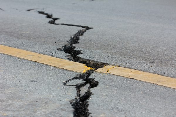
Powerful earthquakes in Venezuela in June renewed questions about how often major earthquakes occur, why some cause more destruction than others and what risks exist closer to home. UNC Charlotte geologist and earthquake expert Andy Bobyarchick answered questions about earthquake activity around the world, North Carolina’s seismic history and advances in earthquake-warning technology.
Are two large-scale earthquakes common in such a short time frame?
Two earthquakes that occur close in time and location are called a doublet. I found 29 examples of doublets or multiple earthquakes with magnitudes above 6.0 in publicly available seismic records since 1892. In fact, Venezuela experienced another set of doublet earthquakes in 2025, with somewhat lower magnitudes than those in 2026. Doublets are not particularly frequent, but we do have many examples.
Why do some earthquakes cause catastrophic damage while others of similar magnitude do not?
We use two kinds of scales to describe earthquakes. Magnitude is a numerical scale computed from records of ground movement and measures the energy released by the earthquake. Intensity measures the effects of ground shaking and human experiences during an earthquake.
The 2026 magnitude 7.5 earthquake in Venezuela was an intensity IX event, classified as “violent” and capable of causing considerable damage. Intensity X is considered “extreme,” and some references extend the scale to XI and XII.
The extent and type of damage within a given intensity zone can vary significantly. Factors include local geology and structural design. A large building not designed for earthquake resistance and built on loosely consolidated sediments may experience far more damage than a better-designed structure built on bedrock. Loose sediments amplify shaking as seismic waves pass through them. Mexico City is a well-known example because much of the city is built on ancient lake sediments.
What are the biggest earthquake threats facing the world today?
The most obvious threat is ground motion from seismic waves. In mountainous regions, earthquakes can also trigger catastrophic landslides. Those landslides may block streams and rivers, causing flooding.
Many of the world’s largest mountain ranges coincide with some of the most active seismic regions because they are located along tectonic plate boundaries. As plates converge, they deform the Earth’s rigid outer layer, the lithosphere, bending and fracturing rocks along those boundaries. Countries along the Himalayan mountain belt experience significant damage because of this tectonic setting.
Are earthquakes becoming more frequent globally, or are we simply detecting more of them?
We don’t have evidence that large earthquakes are becoming more frequent globally. Seismic monitoring systems have been very good for quite some time. It may simply be that social media and instant access to news draw more attention to these events than in the past.
What are the most active seismic zones that could affect North Carolina?
There are two major seismic zones that could affect North Carolina.
One is the Charleston Seismic Zone, which produced an earthquake of approximately magnitude 7.3 in 1886. That event reached intensity X.
The other is the New Madrid Seismic Zone in the central United States, which generated a series of earthquakes in 1811 and 1812 with magnitudes ranging from 7.5 to 7.8. These earthquakes reached intensity X, although some classify the largest event as intensity XII.
These zones are important because large earthquakes in the eastern United States can be felt across very wide areas. The 1886 Charleston earthquake caused structural damage as far away as Charlotte. Modern building codes account for these seismic risks and the region’s history of ground shaking.
Central Virginia and East Tennessee also are recognized seismic zones with more frequent, though generally lower-level, activity.
Notable earthquakes felt in the region include the Giles County, Virginia, earthquake (1897, magnitude 5.6); the Skyland, North Carolina, earthquake (1916, magnitude 5.2); and the Mineral, Virginia, earthquake (2011, magnitude 5.8).
The 2020 Sparta earthquake (magnitude 5.1) is particularly significant because it is the only known North Carolina earthquake definitively associated with a surface-breaking fault, the Little River Fault.
How often does North Carolina experience measurable earthquakes?
“Measurable” is a relative term because detection depends on the sensitivity of the instruments. Most permanent seismic observatories are tuned to report earthquakes of magnitude 1.5 and greater. Generally, people do not feel an earthquake until it reaches magnitude 2.0 or higher.
Between July 2025 and July 2026, 24 earthquakes greater than magnitude 2.0 were recorded in North Carolina. From 1970 through 2025, the average was 4.3 earthquakes per year.
Overall, seismic activity in North Carolina is quite low. Larger events, such as the 2020 Sparta earthquake, can create spikes in the long-term record because they are followed by aftershocks. Since 1900, only about four earthquakes have been recorded with epicenters east of Raleigh.
Some Venezuelans reportedly received earthquake notifications before the shaking began. How does that technology work?
Some countries and U.S. states operate earthquake early-warning systems. When an earthquake occurs, it generates different types of seismic waves that travel at different speeds. The fastest are P-waves, which arrive before the more damaging S-waves.
When monitoring systems detect P-waves, alerts can be sent through cellular networks. Depending on a person’s distance from the epicenter, the warning may provide only a few seconds of notice, but that can be enough time to seek protection.
California, Oregon and Washington use an earthquake early-warning system called ShakeAlert that sends notifications through cellphones and apps.
Countries with earthquake early-warning systems include Japan, Mexico, Taiwan, China, South Korea, Canada (British Columbia), Italy, Romania and Turkey.
Venezuela does not operate a government-run warning system. However, smartphone-based systems can provide alerts by using built-in accelerometers and seismic data. Google’s Android Earthquake Alerts system works this way. During the 2026 earthquake, millions of Android users received warnings.
Dedicated earthquake early-warning systems are complex and expensive. Because most people already carry smartphones equipped with accelerometers, mobile-based alerts provide a relatively inexpensive way to distribute warnings.
How do tsunami warning systems work?
Tsunamis are a hazard associated with earthquakes that occur along coastal fault zones. Tsunami warning systems rely on seismic networks to identify earthquakes, estimate their magnitude and assess tsunami potential.
Several technologies are used. Coastal tide gauges monitor changes in sea level and can detect unusual wave heights associated with tsunamis.
Deep-ocean systems known as DART (Deep-ocean Assessment and Reporting of Tsunamis) stations use pressure sensors on the seafloor that transmit information to surface buoys and then via satellite to warning centers. Numerical models can also predict tsunami travel times and likely impact areas.
Like earthquake warning systems, tsunami monitoring networks are only part of the process. Effective communication systems are also needed to ensure warnings reach emergency managers and the public.
What can people do to prepare for a major earthquake?
A really good source for earthquake preparedness information is the Great ShakeOut website:
The Great ShakeOut Earthquake Drills
The site offers preparedness tips, safety guidance and information on how individuals, families and organizations can practice responding to earthquakes.
Written by: Andy Bobyarchick and Jason Vaughan