Charlotte expert Andy Bobyarchick answers questions about earthquakes
 Major earthquakes have caused immense damage to various parts of the globe in recent years. February’s 7.8 magnitude earthquake in Turkey claimed over 55,000 lives and caused devastation in the region.
Rumors of impending catastrophic earthquakes in California have been perpetuated for decades – but can we actually determine when these may happen? Are the Carolinas at risk for anything more than a mild earthquake? Are our buildings sturdy enough to withstand massive earthquakes?
Andy Bobyarchick, associate professor of geography and earth sciences at UNC Charlotte, and a notable earthquake expert, answers some commonly asked questions.
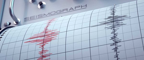
How are earthquakes monitored?
The United States has a comprehensive set of seismic monitoring stations for earthquake detection. The U.S. Geological Survey maintains the National Earthquake Information Center, which oversees the Advanced National Seismic Network’s 15 regional centers.
ANSS is part of the Global Seismographic Network, which extends the U.S. capability to record and archive seismic events around the world.
Seismic activity recording is critical to understanding where and when earthquakes occur. The GSN collects instrumental records of ground shaking, which includes earthquake locations and the magnitudes of ground shaking. Before the middle of the 20th century, seismologists would estimate earthquake events from historical documents like newspapers and eye-witness reports.
Why is it important to collect seismic data?
Seismic data are important because they determine the kind of ground shaking that could occur for an earthquake of a given magnitude in a particular location. These data are used to create earthquake hazard maps and, with refinement, develop earthquake ground-shaking probability estimates. All of this is based on the historical seismic data compilations and our knowledge of the geology and tectonic setting of an area.
Are there codes regarding building construction to withstand earthquakes?
FEMA, the Federal Emergency Management Agency, is concerned with earthquake risks as a participant in the National Earthquake Hazards Reduction Program, established in 1977 to reduce fatalities, injuries and property losses by earthquakes.
FEMA and the other parts of NEHRP compile and recommend seismic building codes that seek to regulate the design and construction of structures. Although some entities have their own building codes, many states and local authorities adopt the building codes of the International Code Council.
The three elements of the International Codes are the International Building Code (almost all kinds of new buildings), the International Residential Code (new homes and townhouses less than three stories) and the International Existing Building Code (modifications in structure or use of existing buildings).
To design and implement effective earthquake-resistant building practices and maintenance, we have to understand the seismic risk of an area. The USGS, FEMA and the Building Seismic Safety Council created seismic design maps suitable for the United States. Building designers and engineers can use this website to get earthquake (ground-shaking) information for a specific site based on the latest building codes.
What can people do to protect themselves during a large earthquake?
If you are indoors during an earthquake, move under protective cover – a sturdy table or desk is best – or crawl next to an interior wall. If you are under a table, hold it with one hand to keep it from moving.
If you have no shelter, cover your head and neck with both hands and arms. For those in wheelchairs, lock the wheels, bend over and cover your head and neck.
Do not run outside or stand in a doorway. In a city with tall buildings, getting to cover applies, too, as debris could fall from high above you.
This document covers other situations for earthquake response and preparedness.
Are there any warning signs before a massive earthquake strikes?
Although you can find references to animal behavior, static electricity displays and other phenomena, we do not have a reliable and verifiable source of warning signs for a large earthquake. Geologists recognize foreshocks — small earthquakes leading to a large release — that, in theoretical terms, are predictors of a larger earthquake, but these are quite rare in practice
This region of North Carolina has experienced relatively mild earthquakes in the past. Are the Carolinas well-suited to handle anything more than what we have experienced?
According to earthquake hazard maps, North Carolina lies within the effective risk regions of Charleston, East Tennessee, New Madrid and possibly Central Virginia. This puts most of North Carolina at a “moderate” risk of exceeding a ground acceleration (shaking) of 0.102 g (a small fraction of gravitational acceleration.)
Based on current knowledge, the probability of a very large earthquake in the seismic zones affecting North Carolina is very low. That does not mean that there could not be more frequent lower-magnitude earthquakes that are felt in the region.
A probable repeat period of 500 years does not mean exactly one large earthquake every 500 years, nor does it mean that the next large earthquake is 500 years in the future. Thus, the U.S. building codes take into account what history dictates.
If a sizable earthquake does occur, it is important to remember to drop, cover and hold on while indoors. If you are outdoors, find an open space, away from any tall buildings. As with any natural disaster – however likely it may be – it is best to coordinate an emergency plan with your family.