If you can, imagine that the sprawling rail yard between North Tryon Street and North Brevard Street, which covers 210 acres and separates the two streets for a dozen blocks, magically went away.
Keep in mind Norfolk Southern has no current plans to move the rail yard. But if they did, what should go on that land?
That’s the challenge a UNC Charlotte urban design professor recently gave her class. Deb Ryan, who also chairs the Charlotte-Mecklenburg Planning Commission, invited several dozen local officials, planners and interested others to a presentation by her Master of Urban Design students from the College of Arts +Architecture.
City manager Marcus Jones, interim planning director Ed McKinney, newly elected City Council member Larken Egleston, urban design program manager Grant Meacci of the city’s Planning Department, and Richard Petersheim, a partner at the planning firm LandDesign, were in the audience.
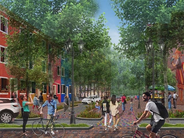
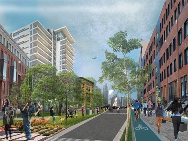
The assignment was purely academic, but Ryan emphasized: “What if the operations of the North Tryon rail yard moved elsewhere? What if we took that big scar in the fabric of the community and turned it into a neighborhood?” The students delivered. They dubbed their neighborhood “The Railyard,” and designed a series of parks, streets, stores, workplaces and homes for an estimated 20,000 people.
Sitting six blocks northeast of Uptown, and on the west edge of two light rail stations (Parkwood Avenue and 25th Street) along the soon-to-open Blue Line Extension, the neighborhood they designed would offer:
- 26 acres of parks and open spaces, including rain gardens – designed to capture stormwater runoff and let plants and soil filter pollutants
- 390,000 square feet of cultural and institutional space
- 170,000 square feet of office space
- 71,000 square feet of “creative space”
- 68,000 square feet of retail space
- 5,900 parking spaces
Among the interesting proposals is a "woonerf" – a Dutch term for a street that shares space among all transportation modes (cars, bicycles, skates, etc.), giving priority to pedestrians.
Other student ideas:
- Adaptively reusing older industrial buildings along North Tryon Street as maker space, for small manufacturers, artisans or other creative uses
- A “mews,” a series of small residences fronting a pedestrian passage used as a gathering space
- “Park Avenue,” a linear park stretching across the site – following today’s rail beds – providing green space, bike paths, recreation and pedestrian paths
- “Madison Park,” not named for the Charlotte neighborhood near Park Road Shopping Center but for a proposed park on the south side of East 23rd Street, modeled on the Pearl District Park in Portland, Oregon, and Madison Square Park in New York City
- “Railyard Park,” dedicated to the area’s rail history, featuring reclaimed shipping containers that can be moved around as pop-up shops
- A Main Street area with ground-floor retail, including a two-story grocery, and condos and townhomes above
- “Bryant Park,” modeled on midtown Manhattan’s Bryant Park, with high-end housing adjacent
Check out more renderings and other potential solutions to challenges facing our community at UNC Charlotte’s Urban Institute's online publication, PlanCharlotte.org.